Post by Udeze Nestor (@Nesmoore1)
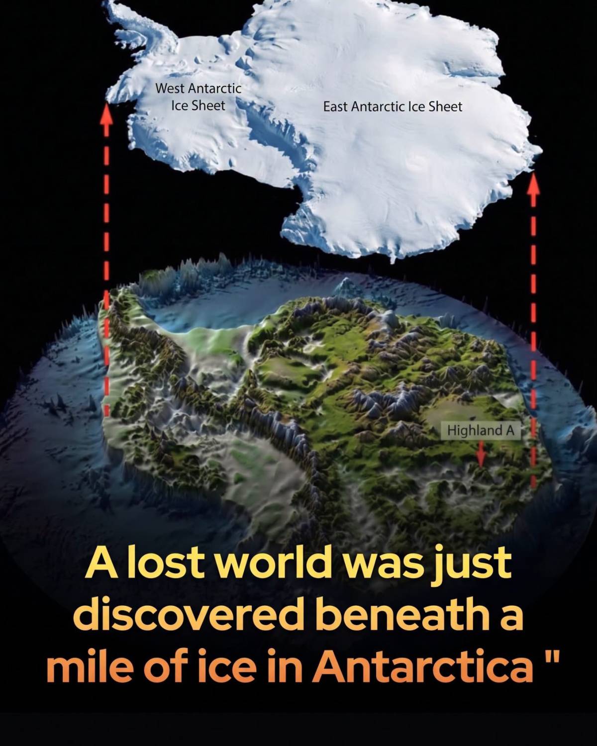
Scientists have discovered a massive, intact 34-million-year-old landscape preserved beneath the East Antarctic Ice Sheet.
Deep beneath the East Antarctic Ice Sheet lies a vast, ancient world frozen in time. Researchers utilizing satellite data and advanced radio-echo sounding have mapped a 12,000-square-mile territory beneath Wilkes Land, revealing an intact landscape of deep river valleys, steep ridges, and high plateaus.
Unlike most areas where moving glaciers violently grind down the bedrock, this prehistoric terrain has been miraculously protected and sealed away by cold, slow-moving ice for up to 34 million years.
This incredible find offers a pristine window into a time when Antarctica was warm, vegetated, and potentially covered in lush forests.
Beyond its historical allure, mapping this subglacial topography is vital for predicting our planetary future. The shape of the bedrock governs how ice sheets move: deep valleys can rapidly channel melting ice into the ocean, while elevated plateaus act as natural speed bumps that help stabilize the ice. By understanding this hidden geography, climate scientists can significantly improve their projections of how East Antarctica will respond to a warming globe. As global temperatures rise, this ancient time capsule is proving to be a critical guide for what lies ahead.
source: Jamieson, S. S. R., Ross, N., Paxman, G. J. G., Clubb, F. J., Young, D. A., Yan, S., Greenbaum, J., Blankenship, D. D., & Siegert, M. J. An ancient river landscape preserved beneath the East Antarctic Ice Sheet. Nature Communications, 14, 6507.
0 likes · 0 comments · 0 shares